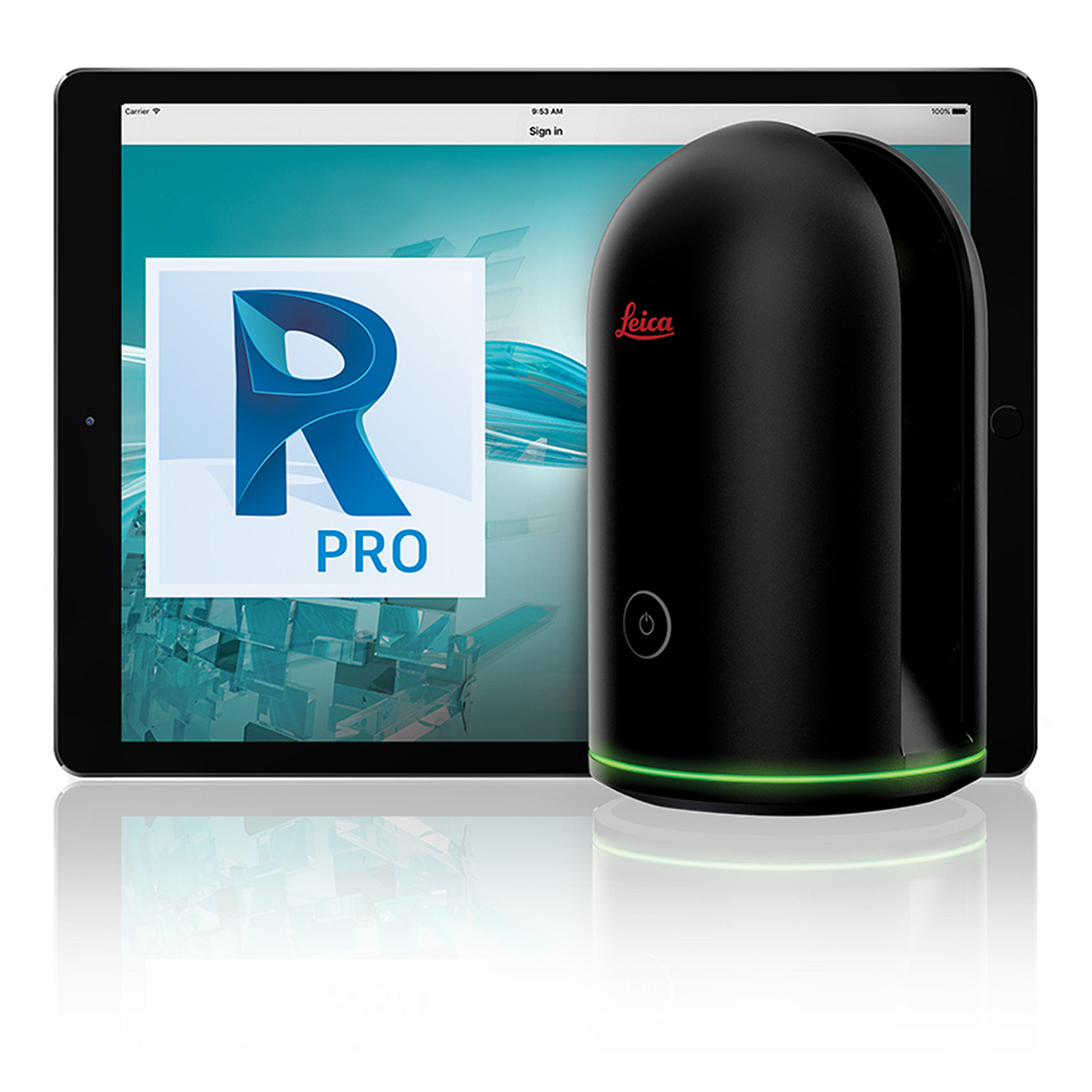

Leica BLK360 Cyclone REGISTER 360
Leica BLK360 for sale come packaged with one year Leica Cyclone REGISTER 360, ReCap Pro Software and BLK360 Mission Kit
Leica BLK360 imaging laser scanner sale packaged with one year Leica Cyclone REGISTER 360, ReCap Pro Software and BLK360 Mission Kit
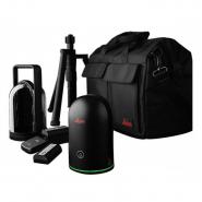
Package includes:
- Leica BLK360 Imaging Laser Scanner
- One year Leica Cyclone REGISTER 360, ReCap Pro Software
- GEB212 Lithium-Ion Battery for the BLK360
- GKL311 Battery Charger
- AC/DC adaptor
- BLK360 Tripod
- iPad Pro 10.5”
- BLK360 Mission Kit
- Leica BLK360 1 Year Warranty
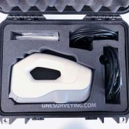
The BLK360 Mission Kit including
- 1x BLK360 Mission bag (853640). The Mission bag has convenient segments for the BLK360 and accessories, including a sleeve for the iPad Pro. The bag is also bolstered for extra protection
- 2x GEB212 Lithium-Ion Battery (772806)
- 1x GKL312 Battery Charger (852 413)
- 1x BLK360 Tripod (853638). The flat fold BLK360 tripod includes the quick release adaptor.
The Leica BLK360 captures the world around you with full-colour panoramic images overlaid on a high-accuracy point cloud. Simple to use with just the single push of one button, the BLK360 is the smallest and lightest of its kind. Anyone who can operate an iPad can now capture the world around them with high resolution 3D panoramic images.
Using Leica Cyclone REGISTER 360 and the Autodesk ReCap Pro mobile-device app, the BLK360 streams image and point cloud data to an iPad or final project data to Cyclone REGISTER 360 via Wi-Fi. With automated workflows in both software offerings, the BLK360 plus the software solution of your choice, dramatically streamlines the reality capture process thereby opening this technology to non-surveying individuals. Simple export of LGS or RCP files makes working with point cloud data downstream in the Leica Geosystems and Autodesk suites simple and efficient, allowing users to spend less time processing data and more time creating meaningful deliverables.
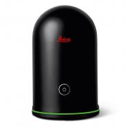
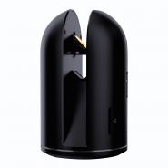
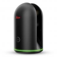
BLK360 imaging laser scanner
- Allows you to scan in high, standard and fast resolutions
- Weighs 1 kg / Size 165 mm tall x 100 mm diameter
- Less than 3 minutes for full-dome scan (in standard resolution) and 150 MP spherical image generation
- 360,000 laser scan setpoints per second
- High-Dynamic Range (HDR) and thermal imaging
- Software offerings to meet your needs
- Bundled with Lecia Geosystems’ next generation of registration software, Cyclone REGISTER 360 for users who want to take on mid-to-large scale projects
Speed: On-the-fly image and point cloud processing in the field and auto-registration office workflows with Cyclone REGISTER 360.
Portability: Flexibility to scan wherever, whenever with the small, lightweight imaging laser scanner that fits into a messenger bag.
Ease of Use: Push-button scanning that automatically stitches and registers in the mobile version of ReCap Pro, transferring seamlessly to Cyclone REGISTER 360 by Wi-Fi for final processing.
Cloud Connectivity: Better collaboration and virtualisation with cloud sync.
Simplified Data Collection: Two-in-one 360º image documentation and laser scan data.
Interoperability: Fully compatible with the Lecia Geosystems High-Definition Surveying (HDS) software suite and Autodesk’s design solutions.
Leica BLK360 Product Specifications |
|
| General | |
| Imaging scanner: | 3D scanner with integrated spherical imaging system and thermography panorama sensor system |
| Design & Physical | |
| Housing: | Black anodized aluminium |
| Dimensions: | Height: 165 mm / Diameter: 100 mm |
| Weight: | 1kg |
| Transport cover: | Hood with integrated fl oorstand |
| Mounting mechanism: | Button-press quick release |
| Operation | |
| Stand-alone operation: | One-button operation |
| Remote operation: | iPad app, Apple iPad Pro® 12.9” or 10.5”/iOS 10 or later |
| Wireless communication: | Integrated wireless LAN (802.11 b/g/n) |
| Internal memory: | Storage for > 100 setups |
| Instrument orientation: | Upright and upside down |
| Power | |
| Battery type: | Internal, rechargeable Li-Ion battery (Leica GEB212) |
| Capacity: | Typically >40 setups |
| Scanning | |
| Distance measurement system: | High speed time of fl ight enhanced by Waveform Digitizing (WFD) technology |
| Laser class: | 1 (in accordance with IEC 60825-1:2014) |
| Wavelength: | 830 nm |
| Field of view: | 360° (horizontal) / 300° (vertical) |
| Range: | min. 0.6 - up to 60 m |
| Point measurement rate: | up to 360’000 pts / sec |
| Ranging accuracy: | 4mm @ 10m / 7mm @ 20m |
| Measurement modes: | 3 user selectable resolution settings |
| Imaging | |
| Camera System: | 15 Mpixel 3-camera system, 150Mpx full dome capture, HDR, LED fl ash Calibrated spherical image, 360° x 300° |
| Thermal Camera: | Longwave infrared camera Thermal panoramic image, 360° x 70° |
| Perfomance | |
| Measurement speed: | < 3 min for complete fulldome scan, spherical image & thermal image |
| 3D point accuracy: | 6mm @ 10m / 8mm @ 20m |
| Environmental: | |
| Robustness: | Designed for indoor and outdoor use |
| Operating temperature: | +5 to +40° C |
| Dust/Humidity: | Solid particle/liquid ingress protection IP54 (IEC 60529) |
| Data Acquisition | |
| Live image and scanned data streaming | |
| Live data viewing and editing | |
| Automatic tilt measurements | |